Dive Sites
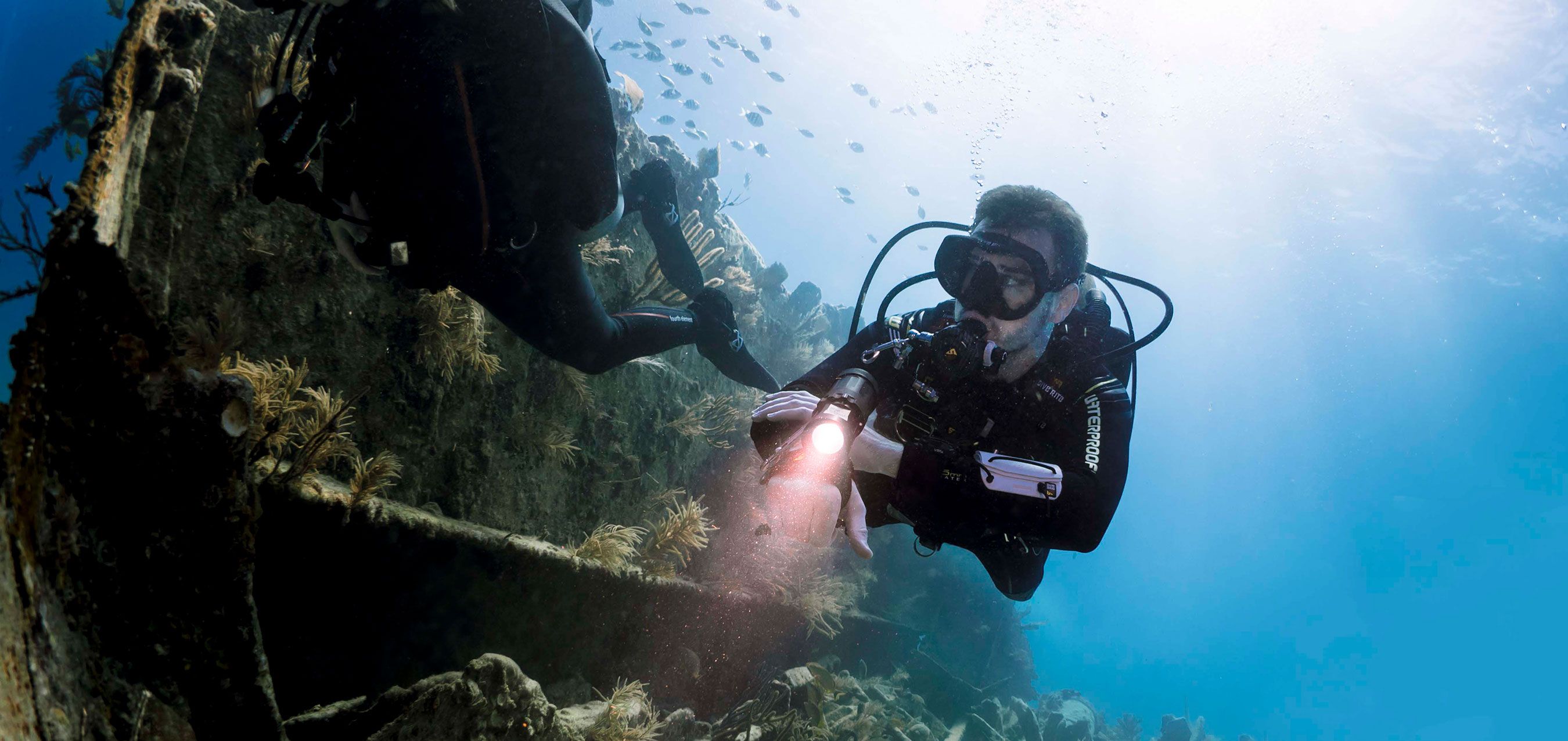
USS Oriskany
The USS Oriskany is a memorial to the thousands of men who served on board during her years of service. NOTHING is to be removed from the ship, and please refrain from placing graffiti on her.
There are many charter operators in the Pensacola area that regularly run trips to the USS Oriskany. Contact us for help in choosing the charter operation that best fits your needs.
Diving the Oriskany is best done with a plan, but not one that is too ambitious. The island itself is larger than most wrecks, and divers can easily spend several dives exploring the upper structure. Plans of the ship are available, and the staff at MBT is available to help you plan your dives - WE DO NOT PLAN YOUR DIVES FOR YOU!
The USS Oriskany sits upright on the bottom in 220ft of water. The top of the smokestack is 84ft deep. Most of the Island including the flag and nav bridges, chart plotting room, captains and admirals at sea cabins, and Pri Fly is above the recreational diving limit of 130ft. The flight deck is 145ft deep, the Hangar Bay is at 175ft.
Tenneco Rig
- DEPTH: 175ft
- DISTANCE FROM SHORE: 22NM S. SE. off the Pensacola Pass
- COORDINATES: 19 59.721’N, 087 05.141’W
- SHIP SPECS: Two 500-ton structures
- LIFE SPAN: Sunk 1982
- BRIEF HISTORY: The Tenneco Oil Rig was brought 275 miles to its final resting place by barge. This is the first use of a complete platform as an artificial reef. Recreational diving should be limited to the upper sections of the structure due to its depth but is a wonderful location for technical dive training containing an abundance of marine life.
MRP Report 003 pp. 139
Antares
- DEPTH: 130 – 140ft
- DISTANCE FROM SHORE: 20.9 NM on a 165-degree course from buoy 12 in Pensacola Pass
- COORDINATES: Between 30 00.582’N, 87 07.775’W & 87 07.768’W
- SHIP SPECS: 387ft steel hulled freighter
- LIFE SPAN: Intentionally sunk in 1995
- BRIEF HISTORY: Before being broken apart by hurricanes the Antares was one of the largest intact artificial reefs in Florida. The stern is the only section still intact and can be reached at around 90ft, the stack is still intact and can be reached at 70ft. This is a great dive; however, it is very deep and penetration into the structure can be extremely dangerous, putting this wreck into an Advanced Diver category.
MRP Report 003 pp.158-159
Avocet
- DEPTH: 100 – 120ft
- DISTANCE FROM SHORE: 20NM off the coast
- COORDINATES: 29 58.369’N, 087 12.603’W
- SHIP SPECS: 247ft length, 40ft beam, separated in two sections
- LIFE SPAN: 1943 - 1991
- BRIEF HISTORY: The Avocet is a 2,640-ton clamshell dredge that was intentionally sunk to become an artificial reef site #20. At one point the hull was intact; however, over time it has been split into two sections approximately 7ft apart. The upper structure is accessible at 70ft.
MRP Report 003 pp. 151
YDT 14 – USS Phoebus
- DEPTH: 100ft
- DISTANCE FROM SHORE: 18NM S.E off the Pensacola Pass
- COORDINATES: 30 05.330’N, 087 09.64’W
- SHIP SPECS: 132.5ft steel-hulled US NAVY Vessel
- LIFE SPAN: 1942 - 2000
- BRIEF HISTORY: The ship was originally placed in the New York Navy Yard as a self-propelled covered lighter 294 with the name YF-294. During WWII she was assigned to the 10th Naval district as an inter-island supply vessel. She was reassigned to the 5th naval district in 1947 and was given the name Phoebus and redesigned as a diving tender, YDT-14. She was intentionally sunk next to the YDT-15. The upper structure of the wreck can be found at 65ft. Barracuda can typically be found enjoying this site. It is #4 on the panhandle shipwreck trail.
MRP Report 003 pp. 169-170
YDT 15 – USS Suitland
- DEPTH: 98 - 100ft
- DISTANCE FROM SHORE: 18NM S.E off the coast
- COORDINATES: 30 05.267’N 087 09.55’W
- SHIP SPECS: 132.5ft steel-hulled US NAVY Vessel
- LIFE SPAN: 1943 - 2000
- BRIEF HISTORY: The ship was originally placed in the 3rd Naval District at New York City as a self-propelled covered lighter No. 336 with the name YF-336. She was reassigned to the Potomac River Naval Command. In 1965 she was named Suitland at the 5th Naval District, Norfolk, VA. In 1971 she was redesigned as a diving tender, YDT-15. The decking and bridge were removed to make the wreck safer for recreational divers. The upper structure of the wreck can be found at 75ft. It is #4 with YDT-14 on the panhandle shipwreck trail.
MRP Report 003 pp. 170-171
Chevron Rig
- DEPTH: 134ft
- DISTANCE FROM SHORE: 18NM off the coast
- COORDINATES: 30 04.242N’, 087 02.120’W
- SHIP SPECS: Two large platform jackets, side-by-side
- LIFE SPAN: Intentionally sunk in 1993
- BRIEF HISTORY: In 1979 the “Rigs to Reef '' program began to retire natural gas and oil structures (platforms) were placed in offshore sites to create reefs. The Chevron Oil Co. donated the two large platforms for the program. The upper section of the rigs set 50 ft off the sand making this a deeper dive, for those with some experience diving. You can typically find good visibility with large schools of fish including amberjacks.
MRP Report 003 pp. 154
Pete Tide II
- DEPTH: 100 – 105ft
- DISTANCE FROM SHORE: 12NM S. off the Pensacola Pass
- COORDINATES: 30 08.767’N, 087 14.017’W
- SHIP SPECS: 166.4ft length, 38ft beam, and 13.5ft draft
- LIFE SPAN: 1979 - 1993
- BRIEF HISTORY: Pete Tide II was an oil rig supply ship that was intentionally sunk by Escambia County. Pete Tide I was destroyed in a fire, thus creating Pete Tide II. The upper structure is accessible at 60ft and sits upright. One can typically find schools of spadefish and minnows hanging out in the intact pilothouse. Its intact hull is an enticing dive spot for advanced divers. It is #3 on the panhandle shipwreck trail.
MRP Report 003 pp. 153 http://www.floridapanhandledivetrail.com/pete-tide.html
Ocean Winds
- DEPTH: 82ft
- DISTANCE FROM SHORE: 10NM off the coast
- COORDINATES: 30 10.995’N, 87 12.017’W
- SHIP SPECS: 82ft length
- LIFE SPAN: 2012 - 2016
- BRIEF HISTORY: The Ocean Winds is a 82ft tugboat that was commissioned to tow and sink many of the artificial reefs in Escambia County. She was ultimately decommissioned and purchased by Escambia County to be made into an artificial reef 10 miles offshore. Fittingly, she was brought out to the spot where she towed many vessels to their final resting place and now sits alongside them for recreational divers to enjoy.
MRP Report 003 pp. 201
San Pablo AKA Russian Freighter
- DEPTH: 80ft
- DISTANCE FROM SHORE: 9 miles off the coast
- COORDINATES: 30 11.333’N, 87 13.057’W
- SHIP SPECS: 315.3ft length, 44.3ft beam, 28ft draft, and displacing 3,305 tons
- LIFE SPAN: 1915 - 1943
- BRIEF HISTORY: The history of the San Pablo Wreck is one of the most interesting in Pensacola, mainly for the local tales that are associated with it. In 1931 she was found registered in Panama for Balboa Shipping Co. In 1942 two torpedoes were fired at her by a German submarine, while tied to a pier in Costa Rica. The torpedoes caused the bridge in the #1 and #2 holds to quickly fill with water due to the watertight doors being open. She quickly settled to the bottom, causing 24 fatalities. She was raised in 1943 for repairs but was ultimately declared a total loss and was brought to Pensacola for training on Project Campbell during WWII. Project Campbell is a H.E. missile-craft, that was operated by remote radio control, with the aid of television. This project was originally classified causing locals to create their own stories of what happened. She is commonly called the Russian Freighter because of rumors of espionage and spies that were circulating during the mid-1940s. There is obvious damage on the wreck site from its history and sinking during training, thus giving her the current nickname, Russian Freighter. The stern and boilers are still intact for recreational divers to enjoy. It is #2 on the panhandle shipwreck trail.
MRP Report 003 pp. 104 and http://www.floridapanhandledivetrail.com/san-pablo.html https://cgsc.contentdm.oclc.org/digital/collection/p4013coll8/id/3041/
Liberty Ship
- DEPTH: 80ft
- DISTANCE FROM SHORE: 7NM E. SE. of the Pensacola Pass
- COORDINATES: 30 16.390’N, 086 09.56’W
- SHIP SPECS: 480ft long liberty ship with her sides 20ft off the sand
- LIFE SPAN: 1946 - 1976
- BRIEF HISTORY: The Liberty Ship ‘Joseph L. Meek’ was built for the Maritime Commission, operating under the U.S. war shipping administration. She was one of the “Ugly Duckling” ships rapidly constructed during WWII and was used to transport troops and cargo to the Allied Forces in Europe. She was intentionally sunk by the Department of Commerce in 1976. Many fishman enjoy this wreck leading to there being many resident sharks who like to hang around the site.
MRP Report 003 pp. 129
Tex Edwards Barge
- DEPTH: 60-75ft
- DISTANCE FROM SHORE: 6.5NM E. SE of Pensacola Pass
- COORDINATES: 30 17.450' N, 87 13.257' W
- SHIP SPECS: Large intact barge
- LIFE SPAN: Sunk 1982
- BRIEF HISTORY: This large, intact barge is home to many different types of marine life including snapper, triggerfish, amberjack, and many different species of tropical fish. It was intentionally sunk on New Year’s Eve 1982.
MRP Report 003 pp. 139
Three Coal Barges
- DEPTH: 50ft
- DISTANCE FROM SHORE: 5NM E. SE. off the Pensacola Pass
- COORDINATES: 30 17.450’N, 085 38-23.40’W
- SHIP SPECS: three 200ft barges
- LIFE SPAN: Sunk in 1974
- BRIEF HISTORY: In 1974 the three barges broke free from their transport vessel and landed in their final resting place. To prevent the barges from being hazardous to other vessels, explosives experts from the U.S. Navy decided to sink the barges to create an easy, safe diving experience for all dive levels. Divers can find a vast amount of marine life and shells. Hurricanes have hit this site hard and could have been moved around or covered. The Three Barges are #1 on the Panhandle Shipwreck Trail.
MRP Report 003 pp. 125 http://www.floridapanhandledivetrail.com/three-barges.html
Joe Patti Barge
- DEPTH: 50ft
- DISTANCE FROM SHORE: 3NM E off the Pensacola Pass
- COORDINATES: 30 17.330’N, 87 13.755’W
- SHIP SPECS: 175ft length, 40ft beam, 10ft draft
- LIFE SPAN: 2013
- BRIEF HISTORY: The Joe Patti Barge is named after a Sicilian fishing boat captain who founded the Joe Patti Seafood Company. His first fish market was opened in 1935 and is still operational in Pensacola as one of the largest seafood markets in town. The metalwork that can be found welded to the Barge represents all things Pensacola. There is a mock bar with stools and colorful beer mugs along the barge, giving a welcoming adventure for those living or visiting Pensacola. The upper structure sits at just 35ft making it a fantastic dive for all experience levels.
MRP Report 003 pp. 194
USS Massachusetts
- DEPTH: 25 – 30FT
- DISTANCE FROM SHORE: 1.5NM S., SE. off the Pensacola Pass
- COORDINATES: 30 17.795’N, 87 18.720’W
- SHIP SPECS: 350ft length, 75ft width
- LIFE SPAN: 1896 - 1921
- BRIEF HISTORY: The USS Massachusetts (BB-2) is a heavily armored, heavy caliber battleship that was commissioned in 1896 and is considered one of the nation’s oldest battleships. It was not built with a bilge keel, causing it to be extremely unstable. The Massachusetts participated in the Spanish American War and was used as a gunnery practice ship during WWI. She was sunk in 1921 during a training exercise by guns at Fort Pickens. During WWII NAVY pilots would use her for target practice. Many fishermen enjoy this wreck.
- MRP Report 003 pp. 75
County of Escambia-man made reefs
- Portofino
- Casino Beach
- Perdido Key
- Navarre
- Fort Pickens
- Park West
- In these shore dive one will need a diver-down float flag to see the pilings that are located walking distance from the shore. The depths will vary depending on the tides that day, most will be 15 – 30ft in depth. There will be a variety of marine life including loggerhead turtles that explore the reefs regularly.
Private Charters
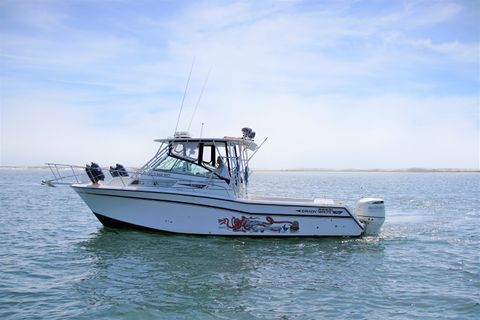
MBT Divers Private Charters- Natare Barathrum
This charter is run on a 30' Grady White located in Mac's Marina that carries a minimum of 4 passengers and a maximum of 6 passengers each trip. The boat has a large forward cabin with a nice private area for changing, a full-size head, and plenty of dry storage. There are custom-built tank racks to safely stow all your dive gear and a large cooler for anything you want to keep cold. There is plenty of room on the deck for everyone to comfortably sit to and from the dive sites. The boat carries all required safety equipment, including a life vest, emergency oxygen/1st Aid Kits, and an AED (defibrillator). There is a divemaster on board for every dive trip.
For private charters, call Captain Dave at (850) 455-7564 or email charters@mbtdivers.com. This boat runs Monday-Thursday. MBT Divers is happy to make arrangements and organize dive trips for you or your group on the Natare Barathrum.
This area offers many cool diving opportunities on artificial reefs and shipwrecks, and multiple charter boats offer trips to them. Don't miss your chance to see part of the shipwreck trail and all the cool history behind the ships. Get on a charter and explore the beautiful Gulf waters!
MBT Divers does not own or operate the below charters. The operators set their policies and prices. Contact the charters directly to schedule a trip.
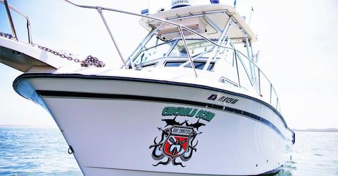
Emerald Ocean Dive Charters
This charter is run on a 28' Grady White located in Bayou Chico that carries a minimum of 4 passengers and a maximum of 6 passengers each trip. The boat has a large forward cabin with a nice private area for changing, a full-size head, and plenty of dry storage. She has custom-built tank racks on the deck to safely stow all your dive gear. There is a large cooler for anything you want to keep cold and two large fish boxes for spearfishing trips. She has plenty of room on the deck for everyone to sit during transit to and from the dive sites comfortably. She has a nice, large, custom-built dive ladder. The boat carries all required safety equipment, including a life vest, emergency oxygen/1st Aid Kits, and an AED (defibrillator). There is a divemaster on board for every dive trip.
Captain David Forrester: 850-512-8701 (text preferred)
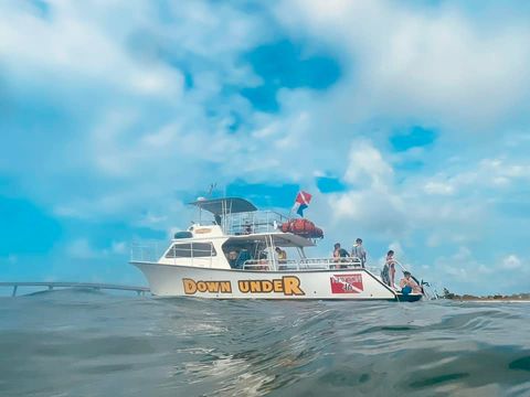
The Dive Boat Down Under
This charter, based out of Orange Beach, AL, is run on a 46' Newton Dive Special and can carry up to 22 divers and 72 tanks. The boat is powered by twin 375 hp turbo diesel engines and features two dive ladders along with abundant gear storage. Fresh water showers and two camera tables are available to keep you and your equipment comfortable.
Safety is this crew's top priority! All safety equipment is maintained and the crew is trained in diving emergency response.
All MBT recommended charter vessels are equipped with proper safety equipment and are operated by Coast Guard licensed and insured captains.